

The Magnolia area, encompassing Magnolia Road and all the residential areas that lead directly from Magnolia Road, lies in the foothills of the Colorado Front Range about five to fifteen miles directly west of Boulder. Its geologic setting is the result of igneous intrusions, mountain-building uplifts, and periods of deep erosion, all encompassing a geologic story that spans one-third of the age of the earth itself. The mining in the Magnolia region, active between 1875 and about the Second World War, is a particularly colorful part of the geologic record.
The entire area lies within a rock body known as the Boulder Creek Granodiorite. Technically, this rock varies in composition from a granite to a granodiorite (loosely speaking, it can be called a "granite"), and formed about 1.67 billion years ago by the slow cooling of a large magma body deep within the earth's crust. The granite is a coarse-grained rock composed primarily of quartz, feldspar, and black minerals (biotite and hornblende). It contains intrusive bodies of lighter material, called aplite (fine-grained) and pegmatite (very coarse grained) dikes, that marked the late stages of cooling of the magma; the dikes formed by the injection of the last, residual liquids into the solidifying granite rock. There are also numerous pods, as long as several tens of meters, of darker, mica-rich, layered rocks "floating" in the granite. These are blocks of older gneiss and schist that were broken off the walls and incorporated into the intruding granite. These older rocks, formed from deep burial and re-crystallization (metamorphism) of ancient sedimentary and igneous rocks, are exposed in many places around the margins of the Boulder Creek Granodiorite and are only slightly older than the intrusive rock itself. Just west of the Magnolia town site, around mile marker 2.5, is a north-northwest-trending dike, about 30 feet wide, known as the Iron Dike for its rusty appearance. This well-known feature, dated at 1350 million years, extends for over 70 miles, from Rocky Mountain Park to a short distance south of Magnolia Road. The dike rock is called diabase, with the approximate composition of a basalt.
About 300 million years ago, an ancient mountain range formed at approximately the same place as the present Front Range. The coarse sediment shed from this mountain range was deposited in fast-moving rivers and is now a hard rock (Fountain Formation), forming the Flatirons west of Boulder. This "Ancestral Front Range" was long ago eroded to a flat surface and uplift did not recommence until about 70 million years ago (Late Cretaceous Period, just before the demise of the dinosaurs). This period of mountain-building, which lasted for about 20 million years, is known as the Laramide Orogeny and caused the tilting of the Flatirons and other rocks in the mountain backdrop west of Boulder and marked the beginning of the uplift of the present Rocky Mountains. Several large north-trending fault zones (known by the early miners as "reefs," although they were usually barren of economic mineralization) formed during this time; one, the Livingston breccia reef, passes about a quarter mile west of the Magnolia town site.
The Laramide Orogeny was also accompanied by the intrusion of numerous stocks (irregular-shaped, mostly steep-sided bodies as wide as several miles) of mostly granitic rock (monzonite and quartz monzonite, to be exact), such as the Caribou Stock northwest of the Magnolia area. Many of these intrusions are associated with the deposition of economic quantities of gold, silver, tungsten, molybdenum, copper, lead, and zinc. These metals tend to concentrate in the late-stage fluids during cooling of the magma and are mostly precipitated in veins within and peripheral to the intruding body (more about that when we discuss the mineralization of the Magnolia region).
Following the Laramide Orogeny, large parts of the Rockies were eroded to a flat surface ("Rocky Mountain peneplain") during the Eocene and Oligocene epochs (about 50-30 million years ago). Part of this surface, now cut by deep canyons, is dramatically exposed from the western half of Magnolia Road north to Rocky Mountain Park and is defined by a common altitude of almost all the tablelands and ridge tops, including the rolling country surrounding western Magnolia Road. A second period of uplift, from about 10 million to 2 million years ago, was concurrent with the cutting of Boulder Canyon and other deep canyons of the eastern Front Range and essentially formed the mountains as we see them today. Sediment shed during this later period of uplift formed the famous Ogalalla Aquifer, an important water source for the Great Plains.
There are no glacial deposits in the Magnolia area. The nearest ones are the valley-glacier deposits that underlie the town of Nederland and exist a short distance west of Colorado Highway 119.
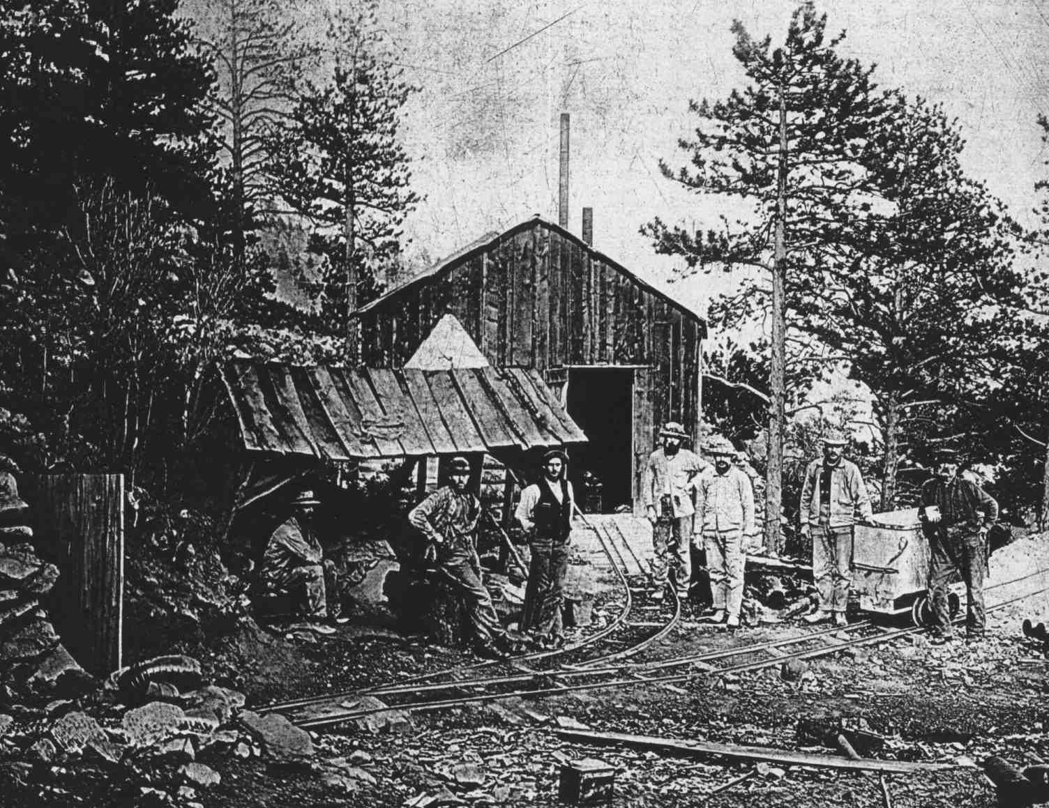 |
| Figure 2.1 Ellis Tunnel |
The discovery of gold in Boulder County in 1859 marked the beginning of a mining boom in the region. In 1875 gold-telluride ore was discovered in the Magnolia area on the Kekionga vein by Hiram Fullen, who opened the Magnolia Mine with two partners, named Stewart and Wilson. During the next two years, nearly all the veins now known in the district were discovered. Dozens of claims were filed in the district and mines sprang up all over. Some of the more productive mines were the American, Kekionga, Keystone, Lady Franklin, Magnolia, Mountain Lion, Sac and Fox, and Senator Hill. Most of the commercial mining was confined to an area less than a square mile, covering the area just northeast of the Magnolia town site and extending southwest to the Kekionga mine. (Magnolia Road cuts right through the dump of the Kekionga mine, at the pullout and viewpoint just above the switchbacks.) However, exploratory adits and shafts pockmark a much greater area than the proven mineralized area. On the Kellogg property, for example, more than 3 miles west of the mined area, there are at least a half dozen tunnels and pits; one of the pits is at least 20 feet deep.
It must have been an exciting and colorful time during the heyday of mining. Mine building, stamp mills, and head frames dotted the hillsides. The town of Magnolia reportedly had a meat market and grocery store, an assay office, a couple of dry goods and drug stores, and three hotels, as well as numerous houses. Early on, the town decided to be dry, a rarity among the mining towns of Colorado, so it had no saloons. It became something of a tourist attraction, however, and by the summer of 1878 the hotels were filling up with visitors anxious to escape to the mountains. A schoolhouse was built some time before 1900 (the home of Ben C. Lovell housed the school before that). Now, all that has changed; only a few flat foundation sites mark where some of the 19th century structures existed.
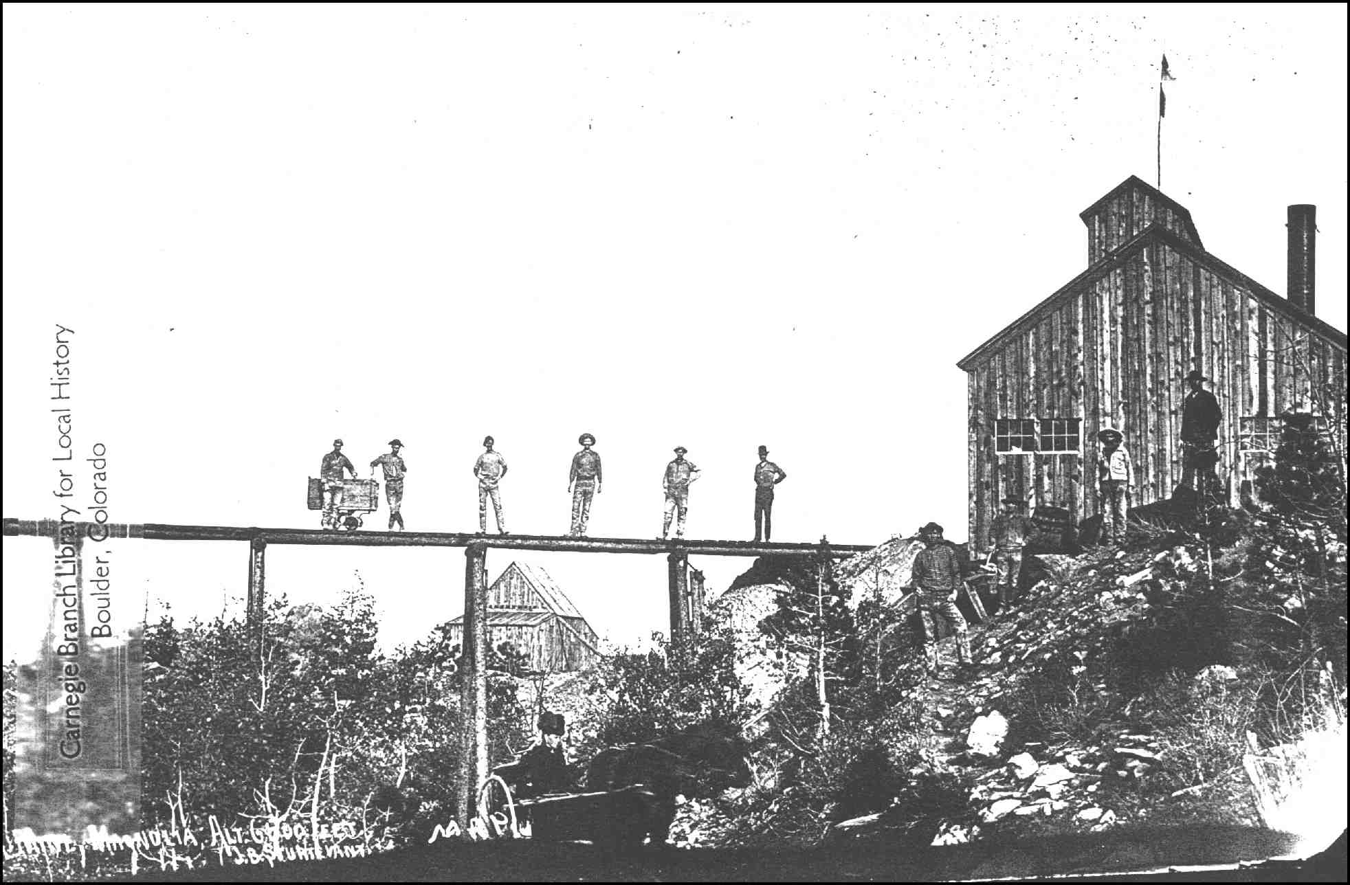 |
| Figure 2.2 Kekionga Mine of Magnolia. |
The mines were very active until about 1910 and began slowly to decline after that. At the then-prevailing prices for gold, which ranged between $16 and $24 an ounce, $2,815,000 in gold was produced up to 1906 (Lovering and Goddard, 1950). Only about $375,000 in gold and several thousand dollars in silver were produced since then. The last production (I could find) for the district (612 oz. gold) was in 1942 (Vanderwilt, 1947). The total production, from 1875 to 1942, was about 150,000 ounces of gold and an unknown quantity (probably less than 50,000 ounces) of silver, which at today's gold prices (about $370/oz.) is worth about $55,000,000 - a tidy sum indeed! Modern gold-exploration ventures, however, do not consider any deposit that contains less than about a million ounces of proven gold. The potential for future mining in the Magnolia district, at least on a large scale, appears very small.
 |
 |