

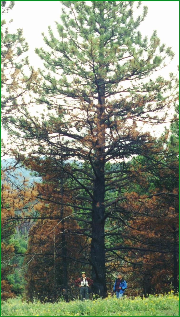
From 1860 to approximately 1910, much of the forests in Boulder County were subject to intensive logging and wildfires of an intensity that was much higher than the historical norm. Mean fire return interval in montane areas during this period was less than 20 years. For approximately the past 90 years, fire suppression has been the dominant wildfire management strategy. As a result, the forests are now full of dead material, including large areas of ponderosa pine killed as a result of an outbreak of the pine bark beetle 20 years ago. Forest fuel loading is very high. Wildfire hazard is compounded since many residents do not keep clear, defensible areas around their homes. The dilemma is how to introduce fire back into the landscape while preserving private property, scenic resources, and recreational opportunities.
The results of fire suppression over the past century are dense, overstocked stands in ponderosa pine woodlands and Douglas-fir forests. If a natural fire regime were in place, ground fires would have eliminated most small trees, and most of the mature trees would be relatively unharmed, resulting in a more open and mature forest interspersed with large meadows. The lack of frequent surface fires permits an accumulation of fuel and an abundance of small trees that serve as fire ladders. The natural forest structure and composition cannot occur by natural means at this time, because the dense forests would succumb to a more destructive stand replacement crown fire where most of the trees, regardless of age and structure class, would be eliminated. This type of wildfire is much more destructive to trees, soils, and wildlife, and is potentially a far greater threat to human life and property.
In ponderosa pine forests, changes in disturbance events since European settlement have resulted in higher densities of trees and canopy closures, while fire frequencies have decreased and fire sizes have increased. These conditions appear to have contributed to an increase in dwarf mistletoe and bark beetle infestations. Impacted stands experience a rate of mortality in excess of typical natural levels, and thus contribute to an abnormal level of woody debris, which in turn contributes to very high levels of wildfire fuel loading.
Historic public policy has been to suppress natural fires; however agencies are rapidly becoming aware that this continued policy contributes to a scenario of catastrophic fires. Traditional commercial logging operations have not typically been designed for wildfire mitigation or to achieve the goals of ecosystem management. Rapidly increasing residential development in the western states in the past two decades has also contributed to the wildfire hazard.
Boulder County is categorized as a wildland/urban interface with escalating human population, residential development on mountain properties, and extremely high demand for forest aesthetic and recreational experiences. Nearly one hundred years of fire suppression and population growth have resulted in densely stocked, low elevation forests that are highly susceptible to catastrophic insect, disease and wildfire events. This situation is exacerbated by large amounts of intermingled public and private lands, residential development, and intensive recreational use. All of these factors increase the potential for human caused wildfire.
The Wildfire Hazard Identification and Mitigation System (WHIMS) was started in 1992 by County government for the western two-thirds of the County. WHIMS educates property owners and firefighters as to the existing wildland fire hazards on any given property and to the subdivision and area as a whole. If property owners are informed about the hazards, they can make more educated decisions as to what, if any, mitigation steps to take. The fire dept. has color coded maps showing high hazard vs. lower hazard areas, as well as potential access problems. The Fire Protection District fills out a simple form on any given property rating specific hazards (i.e. location of propane tank, location of trees in proximity to the house, slope, type of construction materials). A "mitigated" rating is then produced, indicating how much hazard reduction is possible with the implementation of "simple" landscape and structure maintenance measures on the part of the homeowner.
The Boulder County Land Use and Geographic Information System Departments are currently working on an updated wildfire hazard map that will have greater accuracy, higher resolution, and more usefulness than the generalized mapping that currently exists. This improved map will assist public agencies in determining where the greatest hazards exist, and therefore, where wildfire mitigation is most needed.
Property owners are subject to the requirements of the Boulder County Land Use Code. Property owners are also encouraged to consult with the Colorado State Forest Service for advice on wildfire mitigation planning. The State Forest Service and Colorado State University have developed a program to educate mountain residents on wildfire hazard (refer to Appendix 4.1, Contacts, under Wildfire Hazards). Key points are:
After the Black Tiger Fire destroyed 44 homes and burned 2,100 acres in the Sugarloaf area two miles north of the Planning Area, local land management agencies and concerned citizens formed the Boulder County Wildfire Mitigation Group. The goal of the group is to reduce the risk of catastrophic wildfires in the mountains of Boulder County. In 1996 a subgroup formed, the Boulder County Ecosystem Cooperative (BCEC). The goal of BCEC is to develop management plans that address wildfire mitigation, but also incorporate many ecosystem management issues into project design. BCEC stakeholders include:
Boulder County Parks and Open Space Department
Cherryvale Fire Department
City of Boulder Mountain Parks
City of Boulder Open Space
Citizens and Landowners, including PUMA members
Colorado State Forest Service
Denver Water
High Country Fire Protection District
Private Consultants/Contractors>
USDA Forest Service
Colorado Timber Industry Association
National Renewable Energy Laboratory – Golden
Early on in its deliberations, BCEC began to focus on the wildland/urban interface in southwestern Boulder County and developed the Winiger Ridge Forest Health Restoration project. The 38,000 acre project area includes all of the MEPP Planning Area and additional areas to the east and south, including the Gross Reservoir area and the Boulder Mountain Parks.
With respect to MEPP, some of the key land management issues that BCEC has identified are:
Maintenance of long-term sustainable, resilient, and biologically diverse ecosystems. Low intensity fires should be restored to forested and grassland ecosystems.
Management of forest conditions to reduce the potential for catastrophic insect, disease and fire events.
Management of responsible and balanced recreation uses on public lands, especially with regards to public use of roads, trails, dispersed camping and campfires.
Management of undesirable non-native plants.
The planning and implementation of BCEC’s goals have included community participation, integration of landscape ecology principles, integration of ecosystem management guidelines, and provisions for monitoring of project level management actions. Such actions will include mechanical thinning of densely stocked mixed conifer/ponderosa pine forests, regeneration of aspen and restoration of mountain meadows, and prescribed fire. The Colorado State Forest Service (1997) has described this project in greater detail. The Forest Service component has been funded for six years. Some management actions have been initiated, including a prescribed fire on Winiger Ridge in October 1998, and forest thinning in the Twin Sisters area.
This interagency cooperation, embracing of ecosystem management, and dialogue with residents of the area holds great promise for restoring a sustainable and healthier ecosystem in the Planning Area. This is a sophisticated project, with many complicated components. Ecosystem management is a relatively new management technique, and as such is untested. Potential problems and pitfalls with the program have been identified by PUMA members and local residents. PUMA has developed recommendations to address potential negative, if unintended, consequences of the project (refer to Section 4.9.2).
 |
 |