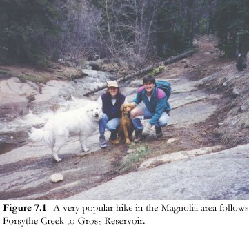

The Magnolia Planning Area of 14,100 acres consists of public lands administered by the Arapaho and Roosevelt National Forest (62.2 percent), Boulder County Parks and Open Space Department (11.7 percent), Denver Water (less than 1 percent) and private parcels (26.1 percent). Virtually all of the public lands are available for public recreation. Based upon the administering agency, the types of recreational uses allowed on the lands vary, and these uses are administered from offices located as close as the city of Boulder to as far as Washington D. C.
Boulder County Parks and Open Space is managed for passive recreational use only. No hunting, camping, campfires or motorized travel are permitted on these lands. Boulder County has acquired land within the Planning Area only since October of 1994. Management plans for these parcels are now in the final stages of being completed.
 National
Forest lands (Forest land) are subject to multiple-use management. Recreation
includes hiking, biking, vehicular use (including four-wheel drive) camping,
hunting, and firearm shooting. Unlike many other public lands in Boulder County,
recreational users are also required at times to share the land with grazing,
logging and mining land uses, although these land uses are subject to numerous
regulations and administrative procedures. The land on the west shore of Gross
Reservoir is primarily Forest land, with Denver Water controlling approximately
50 acres at the eastern terminus of Winiger Ridge. However, Denver Water's jurisdiction
extends approximately one-quarter to one-half mile farther west onto Forest
land by virtue of the Federal Energy Regulatory Commission's (FERC) licensing
authority on Denver Water's hydroelectric facilities at the reservoir. On Forest
land within the FERC permit boundary, Denver Water and the Forest Service are
required to jointly implement management plans. Camping, fishing, 4WD, mountain
biking, hunting and hiking are allowed on this land. The western shoreline of
the reservoir forms the eastern-most portion of the Planning Area.
Enforcement of recreational violations on private lands is the jurisdiction of the County Sheriff. Sheriff deputies also support the law enforcement personnel of the County Parks and Open Space Department (POSD), Forest Service and Denver Water.
Jurisdiction of recreational uses in the Planning Area is complicated further since road access to a public parcel may be controlled by a different agency than the agency that administers the parcel. The most important example of this situation within the Planning Area is County Road 68J, administered by the Boulder County Department of Transportation (BDOT). This road controls the primary point of access to Forest land on the west side of Gross Reservoir. Recreation management therefore requires the participation of many agencies at the local, state and federal levels, and the participation of local residents, property owners, recreational user groups, and environmental organizations.
Both local residents and non-locals use the area for recreation. Primary recreational use of public lands in the Planning Area are hiking, mountain biking, horse back riding, running, birdwatching, shooting, camping, and hunting. Vehicular use includes 4WD, all terrain vehicles, and off road motorcycle use. As population grows in Boulder County, the pressures on the recreational and ecological resources in the Planning Area increase. Current growth rates in Boulder County are 2.5 percent. With our population now at 272,700 people, the County could grow to 325,000 by 2006 if this same growth rate continues. Clearly, planned, orderly development and maintenance of recreation amenities in the future will benefit both local residents and visitors.
 |
 |