
POSD is completing management plans for its land; recreational facilities on this land are not fully developed at this time. The Forest Service has developed a road and trails inventory that is to be used for the development of the travel management plan, now in progress. Denver Water has recently completed a Recreational Management Plan that has been submitted to FERC for approval. By means of these plans and inventories, the condition of recreation infrastructure can be described in general terms. However, there is no definitive information documenting the recreation use of the Planning Area, particularly by quantification of various recreation uses and by recreation user days.
 Public
lands within the Planning Area may be subdivided into three blocks as follows:
Public
lands within the Planning Area may be subdivided into three blocks as follows:
Western Block--including 1) Boulder County's Rogers, Reynolds Ranch and Platt Rogers Memorial Park (western half) properties, 2) Forest land along Highway 119, 3) Forest land in the Boy Scout and Front Range trails area (centered on Section 16 and 4) scattered Forest land near to the south and east boundary of Reynolds Ranch. Recreation facilities are primarily composed of old logging roads, social trails, and Public Service Company's aqueduct (Aqueduct). Forest Roads include 357 in Section 16, 606 in Section 17, 2041 in Section 19, 356 and 2042 in Section 20. These facilities are primarily used by mountain bikers, hikers, runners, and equestrians. Most of the Forest Roads are gated, thus restricting or prohibiting vehicular access. The social trails are not officially recognized as part of the Forest Service system.
Northeastern Block--including 1) the eastern half of the Platt Rogers Memorial Park, 2) Forest land north of Stilson's Ranch in Sections 1, 2, 10 and 11, 3) Forest land on Twin Sisters Peak, and 4) Forest land in Calhoun, Keystone and Hawkin Gulches. Recreation facilities are primarily old logging roads, social trails, and the Aqueduct. Forest Roads include 2050 in Sections 1 and 2, and Forest Road 2051 on Twin Sisters Peak. These facilities are primarily used by mountain bikers, hikers, and runners. Most of the Forest Roads are gated, thus restricting or prohibiting vehicular access. There is an informal trail to the summit of Twin Sisters Peak.
Southeastern Block--including 1) Forest land on Winiger Ridge, Winiger Gulch, and South Boulder Creek, and 2) Forest land and Denver Water land on the west shore of Gross Reservoir. Forest Roads include 238 in Winiger Gulch (which connects to County Road 97E in the Lazy Z subdivision), 359 on Winiger Ridge east to the west shore of Gross Reservoir, and 2040 that connects Winiger Gulch to Pinecliff. These facilities are primarily used by mountain bikers, 4WD, ATV and motorcyle enthusiasts, hikers, runners, equestrians, and hunters. Some of the Forest roads are gated permanently, others seasonally. However, restriction of vehicular access has been inconsistent to nonexistent at times. Spur roads that are not part of the Forest Service system abound in this area. Camp fire rings are scattered throughout. Access to this area is from three directions: 1) CR68J on the north, 2) CR97E on the west, and private roads north of Pinecliff.
Local residents have numerous complaints regarding abuse of public lands and violations of private property rights by recreational users in the Planning Area. Complaints include:
inappropriate off-road vehicle use, including driving through wetlands, riparian zones, creation of unauthorized parallel and spur roads on public lands, and trespass on private lands
unregulated and indiscriminate use of campfires (without fire rings, fires located in inappropriate areas, no limitation on number, size, or duration of fires)
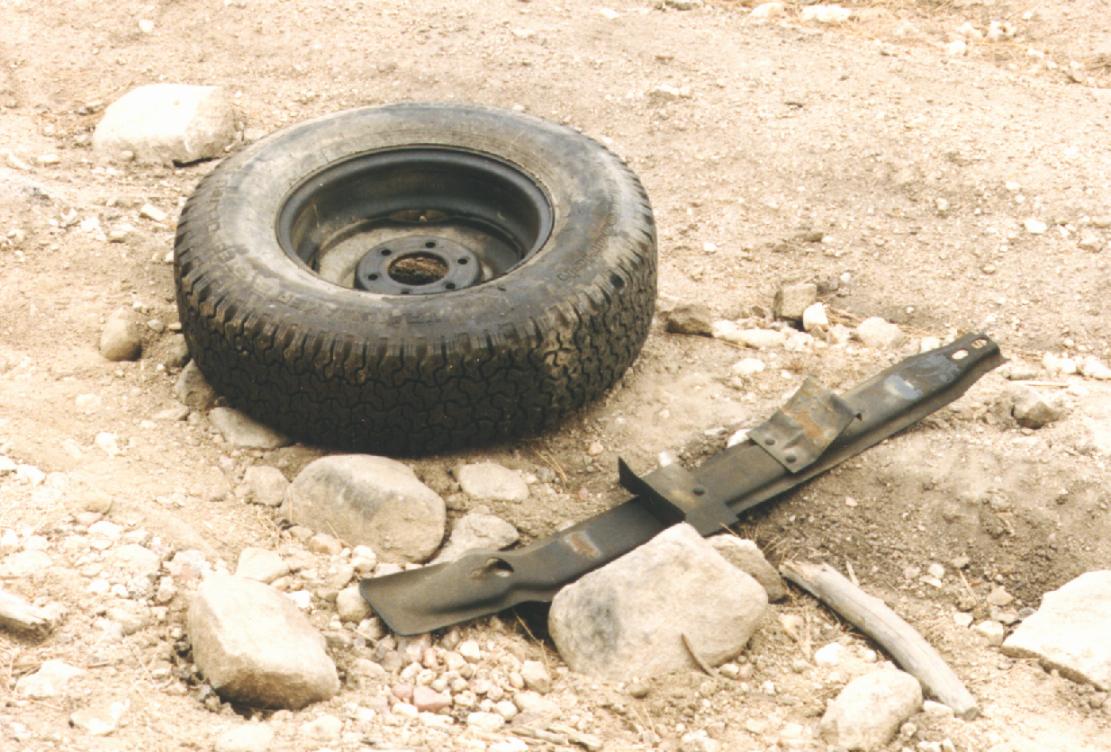
illegal dumping of trash; litter left behind by campers and other recreational users
indiscriminant discharge of firearms, including in areas of high density recreational use or adjacent to private property
conspicuous consumption of alcohol, including drinking while driving and while discharging firearms, and backcountry beer parties
excessive noise from the above activities
unauthorized trail construction on public lands, and development of trails and points of access on private lands without the knowledge or consent of the property owner
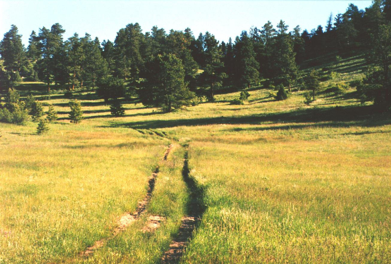
Dirt roads for four wheelers and off road motorcycles and trails for hikers, horseback riders, runners and mountain bikers span much of the Forest land in the Planning Area. PUMA volunteers inventoried and mapped 4WD roads, spur roads and trails on both public and private lands in the Planning Area in the summer of 1997 (map on archive with Dave Kingsbury, PUMA member). Public roads include those administered by Boulder County (County Roads) and the Arapaho and Roosevelt National Forest (Forest roads).
 |
|
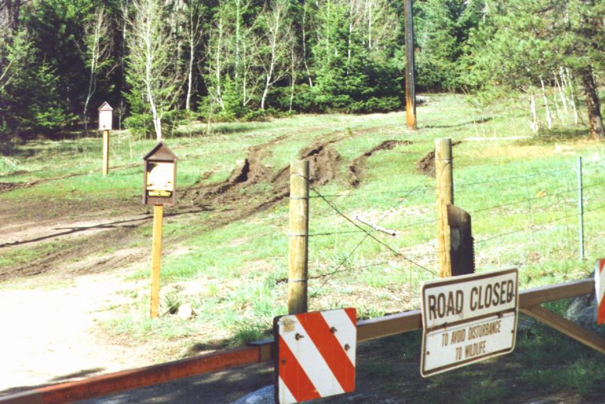
Figure 7.3
A spur road off County Rd 68J cuts across an open field
|
County Road 68J (CR68J) has historically received minimal maintenance and is used by 4WD vehicles, ATVs, motorcycles, mountain bikers, and hikers. This road connects the area on the north side of Gross Reservoir to Magnolia Road. Residents living near CR68J frequently have complained of inappropriate vehicle use, shooting, unsafe campfires, litter, dumping, and noise. PUMA worked with BDOT, Denver Water, Public Service Company, residents of Lakeshore Park Subdivision, POSD, Forest Service, and the Boulder County Sheriff's Department (CR68J Improvement Committee) during the winter of 1996/1997 to develop a plan for the CR68J corridor. The plan was implemented in the summer of 1997. Spur roads off CR68J were closed and signed. Gates were erected on both the Lakeshore Park and Magnolia ends of CR68J. These gates were locked open. Signs were installed along the roadway which said: PRIVATE PROPERTY-NO TRESPASSING, NO DISCHARGE OF FIREARMS, NO CAMPING, NO FIRES and NO LITTERING.
 PUMA
volunteers monitored recreation use on CR68J and adjacent Forest Road 359 (FR359)
areas throughout the summer of 1997 to assess the success of these efforts
(Appendix 7.3). Overall, residents and PUMA monitors noted that the signs, gates and spur
road closures had a very positive effect on recreational use on CR68J: excessive
noise, illegal camping, inappropriate vehicle use, shooting, unsafe fires, littering
and dumping all diminished substantially as the summer progressed. Lakeshore
Park and Magnolia residents were very pleased with the improvement in their
quality of life although a few Magnolia residents complained about the number
of signs on the roadway.
PUMA
volunteers monitored recreation use on CR68J and adjacent Forest Road 359 (FR359)
areas throughout the summer of 1997 to assess the success of these efforts
(Appendix 7.3). Overall, residents and PUMA monitors noted that the signs, gates and spur
road closures had a very positive effect on recreational use on CR68J: excessive
noise, illegal camping, inappropriate vehicle use, shooting, unsafe fires, littering
and dumping all diminished substantially as the summer progressed. Lakeshore
Park and Magnolia residents were very pleased with the improvement in their
quality of life although a few Magnolia residents complained about the number
of signs on the roadway.
FR359, in the Winiger Ridge area, has been documented both by PUMA and the Forest Service as a badly abused corridor for inappropriate vehicle use. PUMA monitors noted that vehicles skirted seasonally closed Forest Service gates, violating the wildlife closure three times in April of 1997. Vehicles were often noted driving off road, destroying vegetation and creating severe erosion. On the Fourth-of-July weekend, vehicles were seen "drag racing" off-road and causing extensive damage. Vehicles illegally drove on Winiger Ridge a total of five different days during the monitoring period. Shooting, drinking, drinking while driving, dumping and littering appeared to be closely linked to inappropriate vehicle use. Also, FR359 has become so badly rutted that cars are driving to the sides of the road, thus widening it and creating more erosion.
 A
conclusion can be drawn by comparison of the management of CR68J and FR359.
Since CR68J has received more focused management attention, recreational abuse
has diminished dramatically. Whereas FR359, which has not received the attention
that CR68J has, continues to be subject to abuse.
A
conclusion can be drawn by comparison of the management of CR68J and FR359.
Since CR68J has received more focused management attention, recreational abuse
has diminished dramatically. Whereas FR359, which has not received the attention
that CR68J has, continues to be subject to abuse.
In the spring of 1998, concerned Magnolia neighbors noted inappropriate motor vehicle use on CR68J. Each spring, the road becomes extremely muddy where the Twin Sisters meadows drains across it, just before the road drops down the hill into the Lakeshore area. 4WD vehicles attempt to skirt around the large mud holes by driving off road into the meadows, thereby causing environmental damage and further widening the road.
The CR68J Improvement Committee met again in Sept. 1998 to review summer use of the road and discuss possible solutions to the mud problem. The County agreed to contribute a load of small rock to fill the mud-holes and suggested that PUMA members move large rocks to block cars from driving off road in the problem area. This work was completed in the Fall of 1998.
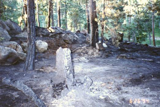 |
| Figure 7.6 A campfire at this campsite was not put out. Fortunately, High Country Fire Department was able to extinguish the resulting fire before it got out of control. |
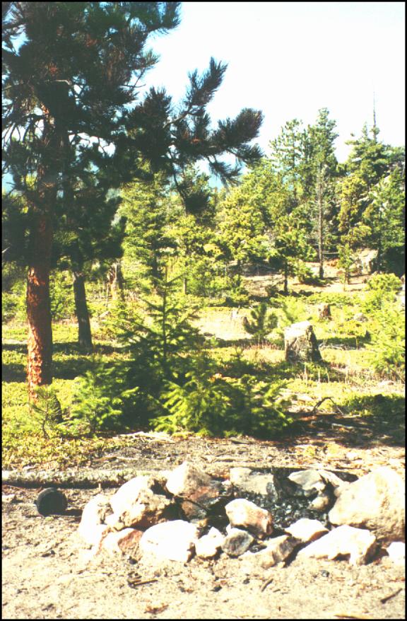
Currently, at least three undesignated campsites with fire rings exist in the FR359 corridor and six campsites with fire rings are located on the western shoreline of Gross Reservoir. All of the campsites have been heavily abused and at Gross Reservoir, there are four wheel drive roads, spur roads, and social trails that criss-cross the area, severely impacting vegetation and damaging habitat. In general, campers on Forest lands build fire rings and camp wherever they please.
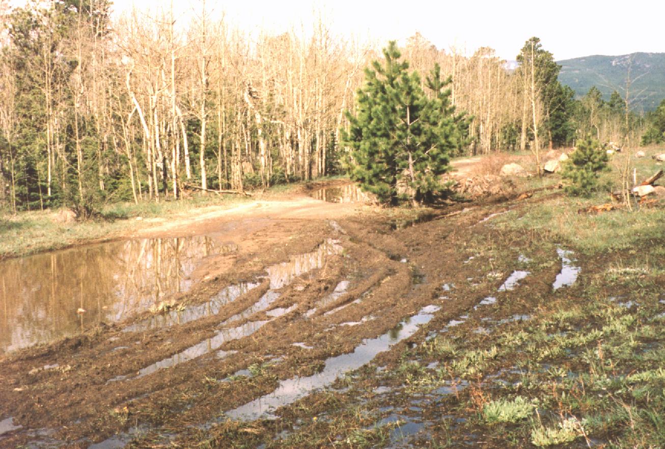 |
| Figure 7.7 CR68J becomes extremely muddy in the Spring. PUMA is working with the County and Lakeshore residents to prevent vehicles from driving off-road in the wet season. PUMA has filled large mud-holes with rock fill and placed boulders to encourage vehicles to stay on the road, or turn back if it is impassable. |
 |
 |