

Gross Reservoir is a drinking water (and soon to be power-generating) reservoir at the eastern boundary of the Planning Area. The reservoir stores 41,118 acre feet and is used as part of the Denver water supply system. Denver Water diverts water from the west slope of the Front Range in the Fraser River area near Fraser and transports it through the pilot bore of the Moffat Tunnel and down South Boulder Creek to Gross Reservoir. Diversion of west slope water total 60,000 acre feet on an average annual basis and is likely to be increased to approximately 66,000 acre feet. About 45 percent of the flow into Gross Reservoir comes from the South Boulder Creek watershed. Approximately 60 percent of the Planning Area (11.9 sq. miles) drains into South Boulder Creek, the balance into Middle Boulder Creek. In total, South Boulder Creek drains about 91 sq. miles (Denver Water, 1997). The Magnolia area which acts as part of the Gross Reservoir watershed is approximately 11.9 sq. mi. (13 percent of the total South Boulder Creek watershed).
Denver Water is researching possible increases in their water supply system to provide municipal water to the rapidly growing metropolitan population. One scenario suggests an increase in the height of Gross Dam by approximately 100 ft. Because of the steep slopes of most of the boundaries of this reservoir, this dam increase would not flood significant new area, but would inundate significant stretches of riparian areas along several small tributary creeks (Forsythe Creek and Winiger Gulch) and South Boulder Creek. Riparian areas are rare in the Planning Area and several have been included in the management prescription of the US Forest Service's 1997 Revised Management Plan (USFS, 1997), and flooding would have major impact on the amount of riparian areas in the Planning Area.
Major creeks are Forsythe Creek (Figure 3.1), draining approximately 5003 acres, or 40 percent of the Planning Area, and Winiger Gulch, draining approximately 2100 acres or 17 percent of the Planning Area. Many other small drainages exist, but are generally seasonal streams or ground water percolation only. Forsythe Creek and Winiger Gulch trend easterly and empty into Gross Reservoir at two of the longest, western-most arms of the reservoir. From observations and comparisons, it is likely that a maximum average flow for either creek would be four to five cubic feet per second (cfs) in mid-May to early June, with minimums of tenths or hundredths of cfs in late fall. No studies have been done to determine the precise flows of the creeks in the Planning Area.
The north slopes of the Magnolia ridge drain directly into Middle Boulder Creek. There are no permanent streams on these slopes, with the single exception of Hawkin Gulch. Even this stream often dries up late in the summer.
Other bodies of water include numerous ponds and small agricultural or industrial (mining) impoundments. These include:
Total non-stream surface water: 8.67 acres (0.07 percent of Planning Area). Although this small amount of surface water suggests that the area is quite dry, there are many lush meadows, wetlands, springs, and seeps throughout the area that create bright pockets of important habitat and aquifer recharge zones. The location, acreage and function of these features are largely undocumented.
 |
|
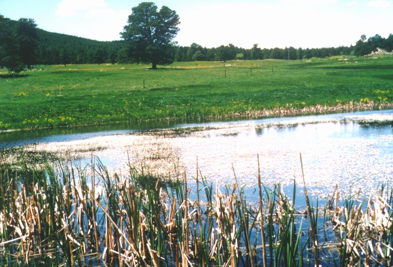
Figure 3.2 Stilson's stock pond
off Magnolia Road.
|
Few water rights are filed in the Planning Area. A complete listing from the Colorado State Engineer, Water Resources Division is provided in Appendix 3.2. Five of the listed water rights are surface water, the other eight are groundwater rights. At present these surface waters are used for irrigation and domestic purposes. The only substantial right is the Wrenn South Boulder Creek right of 2.5 cfs. It appears that this right is filed on Forsythe Creek or its tributary near County Road 68 and Aspen Meadows. It has not been determined whether this right is currently exercised.
Several seasonally occupied cabins and a few permanent residents use springs as a source of domestic water. One notable story recounts how Dick Scates hand dug a half-mile, six-foot-deep trench to bring water from a spring to his family's cabin near mile 7 on Magnolia Drive. Other springs may be used by temporary summer residents. Only minor agricultural uses of surface water have been made on some of the old ranches along Magnolia Road (Don Stilson, personal communication).
There is little surface water in the Planning Area and therefore little potential for diversion. Diversion is more likely to be from modification of drainage patterns by property owners, by draining or ditching wetlands, installation of culverts, driveway construction, or other means. Most residential water is obtained from private wells, however increased withdrawal of groundwater could cause a decrease in stream flow (Hall, Hillier et al, 1980) and/or seeps that maintain wetlands.
Impoundments are another common method for "diverting" water. There are numerous small impoundments (0.1-1 ac.) in the Magnolia area, typically used for agricultural purposes (livestock), occasionally for recreational use. These small ponds may serve as a valuable source of near-permanent water for wildlife, especially during dry years.
Several small impoundments have been created by residents and construction crews, often during construction of access drives to lots, creating a berm that stops the free flow of water and forming a small pond. Examples exist along CR 68 (about mile 1) and Pine Glade Road (about mile 0.2 and 0.5). These and other hand-dug ponds may serve as small "fishin' holes" and children's recreation areas. The stock pond on Stilson's Twin Sisters Ranch, engineered and certified, has been used for ice-skating in the past.
Forsythe Creek and Winiger Gulch are too small to support any significant fish populations and these creeks are often reduced to very small flows during late summer of an average dry year. Gross Reservoir is stocked and heavily fished. The shores are a very popular fisherman's destination, as are South and Middle Boulder Creeks. Both South and Middle Boulder Creeks are regularly run by kayakers, but both are extreme expert runs and the number of qualified kayakers is fairly small at present.
In 1993 Wright Water Engineers of Denver, CO was contracted by Boulder County to identify and map wetlands on all private property in the County. Unfortunately, the USDA Forest Service has not prepared a similar document for their lands in the Planning Area (>76 percent of the Planning Area), although a recently released map shows riparian vegetation which often closely parallels wetlands (USDA Forest Service, 1997). The Boulder County Land Use Dept. maintains a GIS database of wetlands developed as part of the Wright Water studies.
The Wright Water study assessed the following functions of wetlands: groundwater recharge, groundwater discharge, flood storage, shoreline anchoring, sediment trapping, nutrient retention and removal, food chain support, wildlife and fish habitat, active recreation, and passive recreation. Approximately 26 percent of wetlands in the Planning Area may exhibit some disturbance, according to the report. "The relative lushness, productivity, and diversity of habitat types makes many foothills wetlands important for wildlife" (Wright Water Engineers, 1993). Disturbance is most commonly due to roads, bridges, and other development. The only wetland listed in this study as "significant" is along tributaries to Forsythe Creek.
Not included in the Wright Water study, among others, were wetlands adjacent to intermittent streams. Several streams in the Planning Area are intermittent, filling ponds and wetlands along the way. Usually the streams run predictably during spring snowmelt and spring/summer rains. The lack of coverage by the Wright Water study would suggest that some of the critical aquifer recharge areas are not listed, not mapped, and not protected under current Boulder County wetlands regulations. This may be a serious oversight for an otherwise dry region such as the Magnolia area.
Local mapping of the National Wetlands Inventory (produced by the US Department of Interior and on file with the Boulder County Parks and Open Space Department) documents approximately 15 other wetland sites within the Planning Area. Since this information is based upon photo interpretation of satellite imagery, the data are not reliable unless field checked. This inventory may be useful as a basis for additional field work.
Existing controls for wetland activities in the County include federal regulations governed by the Clean Water Act. Nationwide and general permits that allow dredge and fill of wetlands are administered by the US Army Corps of Engineers, with additional oversight by the US Environmental Protection Agency. State regulations do not directly address wetlands; however, requirements for water quality may limit impacts to wetlands.
Regulation of wetlands in the unincorporated areas of the County depends upon applicability of County land use processes such as subdivision review, special use permit, or site plan review. In these situations, wetlands issues are addressed on a case-by-case basis as part of the environmental review of the land use proposal. When a wetland lies within a Natural Area or Natural Landmark, as designated in the Environmental Resources element of the Boulder County Comprehensive Plan, additional regulations associated with these designations are incorporated into the review of the land use proposal.
Surface water drains through porous soils or directly into fractures in the underlying crystalline-rock, recharging the aquifers. Groundwater in turn runs from springs or seeps, or is pumped back to the surface and used for domestic, agricultural, or industrial purposes. If surface water is contaminated, for example, by disposed industrial wastes or faulty residential septic systems, this contamination may resurface again. Studies completed in Boulder County and neighboring counties show clearly the hydraulic connection between faults, fractures, and joints in underlying crystalline bedrock and both surface and groundwater (Burns, McCrumb et al, 1973; Waltz, 1975; Hall, Hillier et al. 1982; Hall and Johnson, 1979)
A study was undertaken in 1980 by the Boulder County Health Department, the US Geological Survey, and the Colorado Geological Survey, sampling nearly 700 wells and springs, and 37 sites on 18 streams throughout the County. Water quality was found to be generally suitable for municipal supplies, but often exceeded standards for manganese and fecal coliform bacteria contamination. Trace-element contamination was found to be widespread, occurring in 12 of 18 streams sampled. Surface water quality generally degraded as it lost altitude, on its way to the plains. Mining, farming, ranching, and the disposal of municipal and industrial wastes were shown to contribute to this increasing contamination.
A companion study was undertaken in 1996 to compare recent data with the 1976 data of the previous study (Bruce and O'Riley, 1997). Unfortunately, surface water was not re-sampled in the recent study, and the authors caution against drawing conclusions about any trends in water quality without continued sampling over a longer period. The 1996 report notes that "overlying land use can have direct effects on quality of groundwater and that groundwater eventually discharges to surface water streams and lakes."
Fecal coliform bacteria, most commonly a result of human or animal waste, were found in lesser concentrations in mountain streams (no Magnolia-area streams were sampled, but samples were taken from Middle and South Boulder Creeks to which Planning Area streams flow). Fecal coliform bacteria in Boulder and Fourmile Creeks exceeded water quality standards for raw water used for municipal supplies and agricultural purposes. Excessive cadmium, copper, iron, lead, manganese, mercury, selenium, and zinc were found. Cadmium contamination occurred most often, exceeding standards for aquatic life.
In a companion study (Burns, McCrumb et al, 1973), it was recommended that "leach field areas should be a minimum of 100 feet from rivers, streams, lakes, and wells." Also, since there is a large vertical component to the fractures that constitute the crystalline-rock aquifers in the Planning Area, concentrations of animals (for example, in corrals) can lead to contamination of the groundwater. The Wright Water study pointedly stated that "one should consider that the entire area [emphasis added] of fractured crystalline rock comprises the aquifer recharge area." Wright Water suggested that "no leach fields should be constructed within 200 feet of springs, streams, lakes, or wetlands," however the County Health Dept. requires separation of only 50 feet. The reason for this, according to a Health Dept official, is that "the streams are assumed to be contaminated". The assumption here, quite obviously, leads to continued contamination rather than improvement of the County's water resources. A review of this policy may be in order in light of the hydraulic connections between surface and ground water sources.
Cyanide process, heap-leach mining was performed near the Magnolia townsite about the turn of the century. The Colorado Geological Survey studied abandoned mines in the area (Sares and Lovekin, 1992). This and records from the Colorado Inactive Mine Inventory indicate that several sites may bear continued scrutiny.
Water samples taken from an adit in Calhoun Gulch show high iron and copper content. Iron is a common contaminant of local groundwater supplies, as is copper, but the water sampled at this mine was found to be 1500 times the limit for aquatic life (2.3 mg/L vs. 15 ug/L). Therefore, it is possible that in wet years this contaminated water could reach larger water sources (e.g., Boulder Creek) and cause an adverse reaction among aquatic life.
No other samples of mine drainage in the Magnolia area were noted or analyzed during the Colorado Inactive Mine Inventory; however, it should be noted that mines on private land were not always available for study.
Exceedances in the reservoir for ammonia, iron, manganese, and mercury have been documented; however, pH for the reservoir is generally within state standards, (ranging from 7.4 to 7.8, both upstream and downstream of the reservoir). Total dissolved solids also are well below standards upstream and downstream of the reservoir. Mercury (at 3 ug/L) was 300 times the state drinking water standard. Downstream of the reservoir, limits have been exceeded for all three metals (mercury by nearly 27,000 times the State limit).
Fecal coliform in Gross Reservoir is well above state groundwater standards, but well below surface water standards (Table 3.3). While this may be acceptable for municipal water supplies that will be treated before use, the migration rates of bacteria through soils similar to those in the reservoir area suggest that residential wells nearby should be monitored closely, as should leakage from leach fields into the reservoir. The sources of the contamination could be from local or imported water, from mining or agricultural run off, or from road maintenance procedures.
|
Upstream |
Downstream |
Standard |
|
78 colonies/200mL |
29 col/200mL |
200 col/200mL surface water |
 |
 |